
Nepal
Nepal is an extraordinary corner of an increasingly industrialized and distracted world. Outside of major cities like Kathmandu and Pokhara the way of life is simple and deliberate. Home to 8 out of 10 of the world’s tallest mountains, Nepal is a mecca for those who love the outdoors. Venturing into the Himalayas is a soul cleansing good time that everyone should experience. The imposing beauty and grandeur of the world's largest mountain range is indescribable.
The following section is not a country guide to Nepal but instead a trail guide for hiking the Annapurna Circuit independently. Once considered the best trek in the world, the AC’s reputation has slipped a bit recently due to a service road built alongside much of the trail. In short, the road is a controversial addition that is welcomed by most locals living in the area and opposed by trekkers and tour operators. Although the road does take away from portions of the trek, the famous route still sits atop our favorite travel experiences.
Below you will find information on how to get into Nepal and confidently hike the Annapurna Circuit with things like:
Visa
Nepal has a simple visa process. At the Tribhuvan International Airport in Kathmandu it is easy to obtain a visa on arrival. There are automated machines at immigration where you are able to scan your passport, have your picture taken and fill out an electronic form. The machine will give you a receipt to present to the immigration officer. Multiple entry tourist visas cost $25 for 15 days, $40 for 30 days and $100 for 90 days. They only accept cash payments in USD, Euro and other major foreign currencies. Conveniently, there is a currency exchange counter at immigration if needed. The visa itself is a sticker that takes up half a passport page. Additional information on visas can be found here.
What you need
- Your original passport, valid for at least 6 months
- Exit flight leaving Nepal
- Address of your first nights accommodation
when to visit
We arrived in Nepal at the end of February and stayed through the end of March. The mornings were fairly clear with blue skies and clouds generally rolled in a little before noon making visibility hazy in the afternoons. The days were warm and the nights were cold. At the higher altitudes the days and nights got cooler, reaching freezing temperatures the night before the pass. During this time of year the country's national flower, the rhododendron, begins to bloom making for some really beautiful sections. High season in Nepal runs from October to November where you can expect clear skies and warmer weather. Low season is from June to September where monsoons are common.
Budget
Currency: The currency in Nepal is the Nepalese Rupee (NPR).
Conversion Rate: $1 = 107 NPR (September 2016)
Accommodation Food and Drink: In Kathmandu and Pokhara a dorm room bed is around $5 and private rooms can be had for anywhere between $9 to $25. Things are a very different once you get to the starting point of the Annapurna Circuit. The AC is often referred to as a teahouse trek. While trekkers at one point may have stayed in actual teahouses along the route, business savvy villagers have since begun to open basic guesthouses along the way. The guesthouses will have nightly rates running anywhere from $1 to $10. Surprisingly, if you agree to have at least two meals at your guesthouse you can usually negotiate to stay the night for free. With that being said the meals don’t always come cheap especially at higher altitudes. The price for all goods pretty much directly correlates to altitude so the higher you climb the more you pay. It would be safe to budget around $25-$30 per day inclusive of all food, drink, and accommodation.
Tipping: Tipping is not customary at restaurants and guesthouses in Nepal.
what you need before your trek
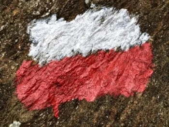
Annapurna Circuit Trail Blaze
Annapurna Conservation Area Permit (ACAP): $22
Trekking Information Management System Card (TIMS): $20
ACAP and TIMS cards are available at the Nepal Tourism Board office, which is about a 15-20 minute walk from *Thamel. Two passport size photos are required for both the TIMS and ACAP permits. All of the paperwork is filled out on the spot and your new permit will be issued on the same day the information is filed. The forms will ask you to provide travel insurance. We did not have travel insurance so we wrote the name of a well known insurance company accompanied by a string of numbers. In our experience this was not an issue.
* Thamel is a tourist corner of Kathmandu full of western restaurants, trekking agencies, and stores selling outdoor gear. It is the landing spot for most travelers in Kathmandu and is a fun place to spend a few days before or after your trek.
Map: $3-8
Annapurna Conservation Area Map: There are a few different options and sizes available. They can be purchased around Kathmandu at local bookstores, trekking shops and even from vendors on the street. Depending on which map you get it will run you anywhere from $3 to $8.
NATT Guide: There is a small pocket size book that you can pick up by Andrees de Ruiter and Prem Rai. It's called “Trekking the Annapurna Circuit Including the NEW NATT- Trails.” The book is a nice to have. It gives some information on the towns along the AC, suggested routes, times along with elevations, side treks and general details about the trail. The book is by no means essential for your trip. If you don’t feel like buying and carrying the small book a free PDF can be downloaded here.
Bus Ticket: $9
You can purchase your bus ticket from Kathmandu to Besisahar at most guesthouses in town for around $9. The ride is six hours and the first bus leaves at 7:00am.
Cost summary of essentials for trekking the Annapurna Circuit:
- Visa: $40
- Permits: $42
- Map: $5
- Bus Ticket: $9
- Food Drink and Accommodation: $25 per day x 16 days
Total: $496
7 Helpful tips to remember before hiking the Annapurna Circuit:
1. Get everything you can in Kathmandu to avoid a headache on the first day of your trek. Things like plenty cash for the entire circuit, cold medicine, sunscreen, chapstick, Diamox for altitude sickness, and a basic first aid kit shouldn’t be forgotten.
2. Don't buy bottled water along the way. Water can be up to $2 per liter and it is recommended to drink 5 liters of water per day. There are plenty of places to fill your water bottle up along the way. Use purification tablets or a steripen to save some cash.
3. Ask if you can stay the night for free if you eat your meals at your guesthouse. More likely than not, you can.
4. Pre-order your meals whenever you can. Most of the meals along the way take about an hour to prepare. Generally speaking the food is made from scratch and cooked on a wood stove. Order breakfast the night before and dinner as soon as you check into your lodge.
5. Wear broken in shoes with thick socks. Blisters are a quick way to ruin a good time.
6. Avoid overpacking. Since the Annapurna Circuit is a teahouse trek, you really don’t need much other than your clothes. The lighter your bag, the easier the trek.
7. For a toasty hot shower look for lodges with gas powered showers instead of solar showers.
How to Trek the Annapurna Circuit in 16 Days
Itinerary Overview:
Day 1: Kathmandu to Bhulbhule
Day 2: Bhulbhule to Jagat
Day 3: Jagat to Bagarchhap
Day 4: Bagarchhap to Chame
Day 5: Chame to Upper Pisang
Day 6: Upper Pisang to Manang
Day 7: Manang (Rest Day)
Day 8: Manang to Yak Kharka
Day 9: Yak Kharka to Thorung Phedi
Day 10: Thorung Phedi to Muktinath
Day 11: Muktinath to Jomsom
Day 12: Jomsom to Kalopani
Day 13: Kalopani to Tatopani
Day 14: Tatopani to Ghorepani
Day 15: Ghorepani to Ghandruk
Day 16: Ghandruk to Kimche
Day 1: Kathmandu to Bhulbhule
How to get to Bhulbhule from Kathmandu:
Step One: Kathmandu to Besisahar
Mode of Transportation: Local bus
Time: 6 hours
Cost: $9
Step Two: Besisahar to Bhulbhule
Mode of Transportation: Local bus
Time: 30 minutes
Cost: $2
In order to get to the beginning of the trail you will need to travel 6 hours from Kathmandu to Besisahar. The first buses leave to Besisahar at 7:00am from Kathmandu. Besisahar is a small town but you’ll be able to find pharmacies and ATMs here. From Besisahar take the local bus to Bhulbhule. It is around a 30-minute bus ride costing $2.
Day 2: Bhulbhule to Jagat (1300m)
Time: 7 hours and 20 minutes
Distance: 16km
Incline: 460m
The first real day of trekking starts along the Marsyangdi River. The trail crosses over a few suspension bridges and passes several waterfalls. You will trek through subtropical forest and rice paddies. Keep an eye out for monkeys around these parts. There is a steady ascent to Bahundanda, which is a nice place to stop for lunch. From there continue on another 4 hours to Jagat to spend the night.

Suspension bridge crossing the Marsyandgi River on the way to Jagat
Day 3: Jagat to Bagarchhap (2160m)
Time: 9 hours
Distance: 17km
Incline: 860m
On day two the trail moves through massive rice terraces and follows a steep vertical cliff. There are fields of corn, barley, and potatoes as well as a few small interesting towns along the walk. There is a bit of a climb today to get up to Tal but after that the trail is pretty mellow. Bagarchhap is a rather small village but there are a few different guesthouses to choose from.

Day 4: Bagarchhap to Chame (2650m)
Time: 6 hours and 25 minutes
Distance: 14km
Incline: 490m
Today is a beautiful day and it really starts to feel like you are in the Himalayas. The trail will offer some nice views of Annapurna II, Annapurna IV, and Lamjung Himal. The day finishes at the town of Chame where small hot springs are advertised. Unfortunately, the spot that was once a hot spring is now an empty cement bathtub that looks like it has been out of commission for quite some time. Hot springs or not, it’s still an incredibly beautiful mountain town to kick back and rest in. This is one of the few towns along the trek that offers basic trekking gear, brand name sunscreen and trail food, so you can stock up on anything you may have forgotten at this point.

Mountains Outside of Chame
Day 5: Chame to Upper Pisang (3300m)
Time: 5 hours
Distance: 14.5km
Incline: 650m
The path is narrow and steep today leading through a dense evergreen forest. The route then travels along a massive rock face before zigzagging across the river on suspension bridges. There is no longer heavy vegetation and the final climb to Upper Pisang is rather difficult. Upper Pisang is a pretty unforgettable night stay as it is nestled between to enormous snow topped mountains.

Man In The Mountain, Ngawal
Day 6: Upper Pisang to Manang (3540m)
Time: 7 hours and 15 minutes
Distance: 19.5km
Incline: 240m
Today opt for the high route via Ghyaru and Ngawal on the way to Manang. This is a beautiful section and should not be missed. The land is becoming more arid and the beginning of the day cuts along a ridge with a stunning view of Annapurna III. The ascent to Ngawal is challenging with numerous switchbacks on the way to the picturesque little village. The viewpoint at Ngwal is rewarding and a nice place to grab some tea. From here it is another 3 hours and 15 minutes to Manang. The rest of the day is not too challenging but the climate does become a bit colder and drier.

Views From the Trail Leading Up To Chongkar Viewpoint
Day 7: Manang Rest Day (3540m)
Manang is a cool little town with big and small lodges ready to cater to the weary trekker. There are a number of small bakeries selling cinnamon rolls, pastries and other delicious snacks that are a real treat at this point in the trek. There are a number of shops selling outdoor gear in case you have managed to break or forget something along the way. They have things like jackets, hats, gloves, poles, socks, base layers and pack covers for sale. Pretty much anything you would expect from a trekking shop in Thamel can be found here. Manang also has a makeshift movie theatre where you can catch a film as you acclimatize.
A reminder about altitude sickness: At the higher elevations there is less oxygen and CO2 in the air. It will be more difficult to breathe and your body will feel weaker. If you have reached Manang you will probably begin to hear murmurs from other trekkers about altitude sickness. For me a slight headache and muscle fatigue was pretty normal, however if you start to feel disoriented or if you vomit the best course of action isn’t to tough it out and continue on but to decrease elevation until you start to feel better.
The general rule of thumb is that above 3,000m you should not sleep much more than 500m higher than the elevation you slept the previous night. You can learn more about altitude sickness and related problems here.
To help yourself get acclimated to the higher altitude, set aside some time on your rest day to climb to the Chongkar Viewpoint. Situated directly below Annapurna III, it is a quick 1-hour hike 300 meters up and it delivers jaw dropping views of Gangapurna Lake below and the surrounding mountainous terrain. This is an incredibly scenic portion that shouldn’t be missed.
Day 8: Manang to Yak Kharka (4050m)
Time: 3 hours
Distance: 9km
Incline: 510m
The trail gains elevation to the village of Tenki above Manang. It then heads out of the Marshyangdi Valley toward the valley of Jarsang Khola. You will see a few juniper trees and shrubs as you head away from the snowy mountains of Manang into more barren lands. The villages begin to almost look abandoned especially in Ghunsa. Yak Kharka is small and basic when compared to Manang but the guesthouse owners are warm and welcoming. Today is a quick and easy hike.

Simple Living, Yak Kharka
Day 9: Yak Kharka to Thorung Phedi (4450m)
Time: 3 hours
Distance: 6km
Incline: 400m
The hike from Yak Kharka to Thorung Phedi is relatively short. The environment is arid and the landscape barren. The trail hugs a steep rocky slope where you’ll see signs cautioning trekkers to walk gently as the area is prone to landslides. The lower guesthouse in Thorung Phedi is fun and laid back. The food here was some of the best on the circuit.

The road to Thorung Phedi
Day 10: Thorung Phedi to Muktinath (3760m)
Time: 9 hours
Distance: 16km
Incline to Thorong La Pass: 966m
Decline from Thorong La Pass to Muktinath: 1,656m
Today is an exciting and exhausting day. The morning begins with an early wake up; we left with a large group around 5:30am and reached the pass by 11:00am. The rapid increase in elevation makes this section particularly tiring. There is a small teahouse at the top of Thorong La Pass that is worthy of a quick stop. After the pass be prepared for a sharp, grueling descent. Make sure to bring ample snacks and water for today's trek as there will not be anywhere to stop for food or drinks for at least another 3 hours following the pass. The closest outpost for food and accommodation past Throrong La is Chaharu Phedi. After you reach Chaharu Phedi the route is not very difficult as you continue on to the Hindu and Buddhist pilgrimage town of Muktinath. The Bob Marley Hotel is an excellent guesthouse with hot showers, delicious food, and a cozy common area.

Day 11: Muktinath to Jomsom (2720m)
Time: 5 hours
Distance: 19km
Decline: 1040m
There are two main ways to get to Jomsom from Muktinath. Most trekkers we spoke with took the route to Kagbeni along the road. This was a highlight for a lot of people as it is a picturesque Tibetan style town unique to this area. There were also rumors of a YakDonalds in Kagbeni. The other route is on the NATT past the small town of Lupra. Along this route the landscape turns dry again with a few dicey patches of loose rocks susceptible to rockslides. Most of the hike is on a dried up, cracked riverbed. There are massive cliffs on both sides of the river dotted with small caves.
The developing town of Jomsom is full of nice guesthouses, several bakeries, and a small airport. Trekkers who are pressed for time will usually catch either a plane or bus back to Kathmandu or Polkara at this point. It is important to note that not all flights leave as scheduled due to inclement weather conditions. It wouldn’t be uncommon to have flight delays for days due to windy conditions.

Riverbed outside of Lupra
Day 12: Jomsom to Kalopani (2535m)
Time: 7 hours and 30 minutes
Distance: 23km
Decline: 185m
Leaving Jomsom and approaching Marpha the trail opens up to a valley full of apple orchards. Marpha is a friendly, hospitable town and a natural place to stop for apple cider and a bite to eat. The day continues with views of Dhaulagai, Tukuche Peak, the three Nilgiris, Fang, and Annapurna I. The majority of the trek will be along a beautifully braided riverbed as the landscape begins to fill with pine trees. It is a long day but the terrain is not overly strenuous. Kalopani offers a lodge far nicer than the other guesthouses along the trek, which is refreshing after the long days walk.

The Apple Orchards of Marpha
Day 13: Kalopani to Tatopani (1200m)
Time: 8 hours
Distance: 20km
Decline: 1,335m
The majority of the trail will be moving downhill as the landscape begins to change back into subtropical forests with more vegetation. The trail passes the popular Rupse Chahara Waterfall. Tatopani is a cozy town, home to an excellent hot spring. The hot spring is naturally heated spring water but the actual pool is laid concrete. There is also an area to shower with fresh hot spring water. The cost to rinse off and take a dip is $1.

Views On the Way to Tatopani
Day 14: Tatopani to Ghorepani (2860m)
Time: 6 hours and 45 minutes
Distance: 14km
Incline: 930m
The stretch from Tatopani to Ghorepani is beautiful and a bit strenuous. The first section up to the Ghara and Sikha is a fairly steep incline however you are rewarded for your effort with views of the terraced rice paddies and inclined farmlands. The combination of the charming villages and drastic scenery are unforgettable. You will find a few nice restaurants in Ghara making it a great place to stop for lunch and soak in the views. After passing Sikha there is a steady climb up to Ghorepani passing through a magnolia and rhododendron forest. This final section is demanding but scenic.

Amazing Views From Sikha
Day 15: Ghorepani to Ghandruk (1940m)
Time: 5 hours and 15 minutes
Distance: 11.5km
Decline: 930m
To see the whole Annapurna and Dhaulagiri massifs head up 3km to the top of Poon Hill for sunrise. There is an entrance fee of $0.50 and the ascent to the top is steep. Here you will likely find hundreds of other tourists with the same idea. It is a bit of a mess with all of the other tourists, but it’s an opportunity to snap some superb pictures. After Poon Hill the walk towards Ghandruk winds through more rhododendron forests, which eventually give way to quality views of the valley below and peaks in the distance. You can expect the trail to be far more crowded today given the large number of tourists who make the 2-3 day treks from Pokhara. Ghandruk is the second largest Gurung settlement in Nepal; it is a quiet, unique little town with big mountain views. It’s a prime spot to relax and reflect on an amazing journey.

Sunrise At Poon Hill
Day 16: Ghandruk to Kimche
Time: 45 minutes
Distance: 4km
Decline: 640m
To catch a bus or jeep to Pokhara make your way to Kimche. This is a short downhill walk past some impressive rice terraces. There are buses and jeeps waiting on the road in Kimche, which make the 2-hour drive to Pokhara. With negotiation the bus was around $2 and the jeep $3 per person. Pokhara’s lakeside area is full of a wide range of accommodation and delicious restaurants. There are also a number of trekking shops in Pokhara that will buy or trade trekking gear. If you no longer need your equipment go see what you can trade it for.

Views From the Outskirts of Ghandruk
Still need help? Questions or comment? Drop us a line and we will get back to you as soon as we can.